Garmin Tread Navigator – Overland XL Edition
Garmin Tread Overland XL: The Definitive Hub for Global Exploration
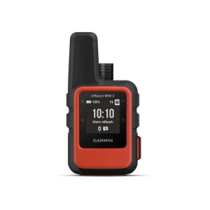
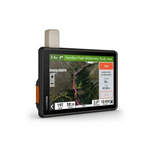
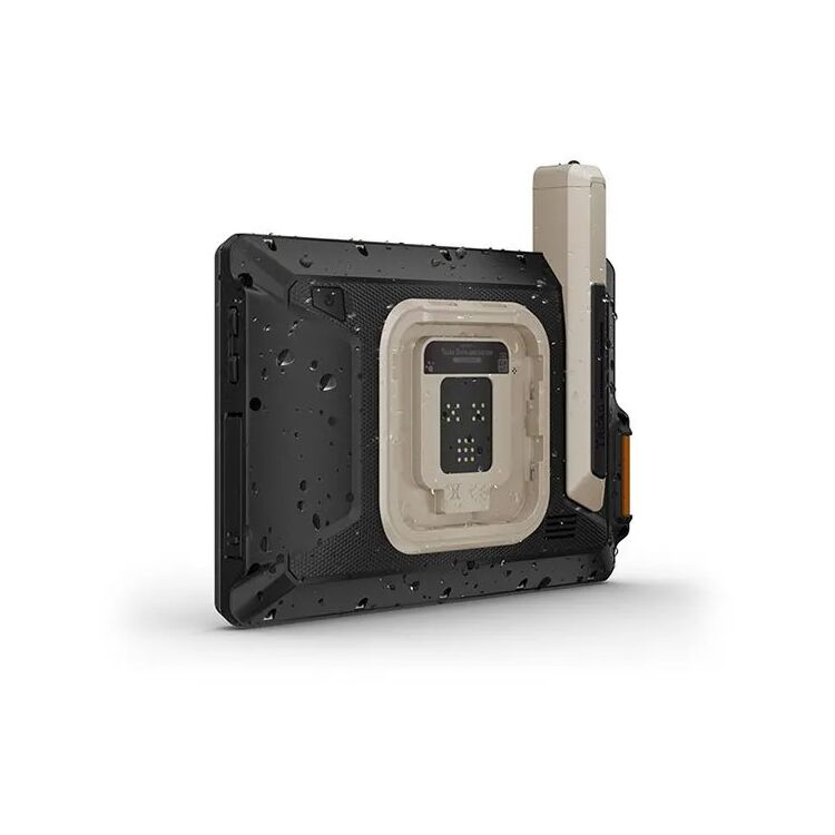
The Garmin Tread® – Overland XL Edition is the premier navigational choice for the 2026 overlander. For those driving larger vehicles like expedition trucks, modified 4x4s, or heavy-duty vans, a standard GPS display simply isn’t enough. The Overland XL solves this with a massive 10-inch high-resolution display that offers unrivaled clarity. This isn’t just a bigger screen; it’s a smarter one. The interface allows for a split-screen view, letting you monitor your topo maps on one side while tracking vehicle pitch and roll or your inReach® messages on the other. Built to MIL-STD-810 standards for thermal and shock resistance and rated IP67 for dust and water protection, this unit is designed to thrive in the vibration-heavy and dusty environments of remote desert and mountain travel.
Global Connectivity and Intelligent Rig Routing
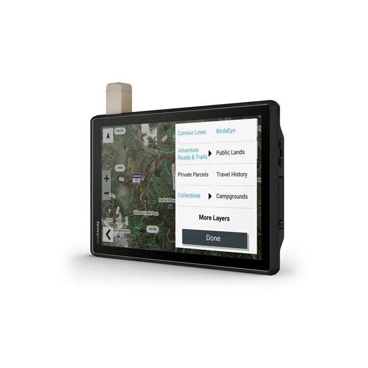
The standout feature of the Overland XL is its integrated inReach® satellite technology. In 2026, safety is non-negotiable; having the ability to send two-way text messages or trigger an SOS via the Iridium® satellite network—completely independent of cell towers—is a game-changer for remote travel. Furthermore, the Tread Overland XL introduces Custom Street Routing for the size and weight of your vehicle. By entering your rig’s dimensions, the GPS helps you avoid routes with weight-restricted bridges or clearances that are too low for your roof rack and gear. For the off-road segments, the unit provides Turn-By-Turn Trail Navigation using OpenStreetMap (OSM) and USFS Motor Vehicle Use Maps, ensuring you stay on sanctioned paths while exploring public lands.
Garmin Tread Overland XL Technical Specifications
- Display: 10.1″ Wide-view IPS (1280 x 800 pixels), Glove-friendly.
- Satellite Tech: Built-in inReach® (Global 2-way messaging and SOS).
- Mapping: North & South America Street/Topo, USFS MVUM, and Birdseye Satellite.
- Sensors: Pitch & Roll Gauges, Altimeter, Barometer, and 3-axis Compass.
- Connectivity: Wi-Fi, Bluetooth, ANT+, and 10Hz GNSS tracking.
- Mounting: Includes heavy-duty suction cup and locking magnetic-assisted mount.
Expert Setup & Overlanding Advice
As experts in expedition-grade electronics, we recommend the Overland XL for large-platform vehicles. Pro Tip: Given the 10-inch screen’s size, mount it using the locking magnetic-assisted cradle on a solid part of your dash to prevent screen bounce during high-speed corrugations. Installation Note: The XL is power-intensive; always use the included high-current power cable directly to a 12V source rather than a low-wattage USB port to ensure the screen remains at peak brightness. Satellite Tip: Remember that inReach® features require a clear view of the sky; if your rig has a full metal roof, try to mount the unit near the windshield. Maintenance Note: Periodically update your maps via the built-in Wi-Fi to get the latest 2026 public land boundaries. Safety Tip: Use the “Track Back” feature as a secondary safety measure; it can guide you back along your breadcrumb trail if you encounter an impassable wash or a closed trail gate.
The Professional Standard for Full-Scale Adventure
Choosing the Garmin Tread Overland XL means investing in unmatched situational awareness and global safety. It offers a unique combination of a massive HD display, specialized vehicle routing, and life-saving satellite communication. For the 2026 overlander who demands the best tool for the world’s toughest roads, the Garmin Tread Overland XL is the unmatched leader. Plan your route, stay in touch, and explore the unknown.
Features:
- Ultra-bright 10″ glove friendly touchscreen able to be viewed in portrait or landscape mode
- IPX7 water resistance rating
- MIL-STD 810 drop rating
- Preloaded with iOverlander POIs and Ultimate Public Campgrounds so you don’t need a cell signal to route to the best-established wild and dispersed campsites
- Customize street navigation for the size and weight of your overlanding vehicle & get alerts for upcoming bridge heights, weight limits, curves, grades and more
- Access U.S. public land boundaries for national forests, Bureau of Land Management (BLM), wilderness areas, and more
- Display U.S. private land boundaries and landowner information for parcels greater than 4 acres
- Growing trail rating database includes difficulty ratings where available across the U.S.
- Built in ABC (altimeter, barometer, compass)
- Pitch and roll angle readings
- inReach compatible with an active subscription
- Subscription-free BirdsEye Satellite Imagery for downloadable aerial views
- Easily sync across Garmin devices, plan routes, track friends, access live weather and more with the Tread smartphone app
- Garmin PowerSwitch compatible – enable on-screen & bluetooth control of your machine’s 12-volt accessories (up to 6 circuits at 30 Amps each)
Includes:
- Tread – Overland XL Edition
- Suction cup mount
- Vehicle power cable
- Locking magnet-assisted mount
- USB-C cable
- Documentation
| Product Style | AmericanV-twin Item # | Catalog Number | Store Sku | MFR. Product # | Availability |
|---|---|---|---|---|---|
| Garmin Tread Navigator – Overland XL Edition | 64384 | 64384 | 010-02509-00 | In Stock: Ships within 24 hours |